 Stefani Rindus
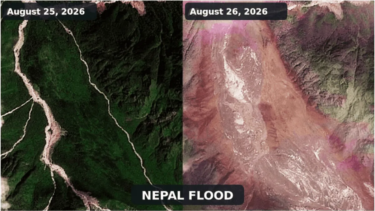
KATHMANDU – Recent satellite images captured by the European Union's Copernicus system dramatically reveal the scale of devastation following a powerful flash flood that struck the border region of Nepal and Tibet on August 26, 2026. Visual comparisons of satellite photos taken before and after the event show a astonishing transformation of the landscape, highlighting the destruction of vital infrastructure and significant topographical changes to rivers as a result of this natural disaster.
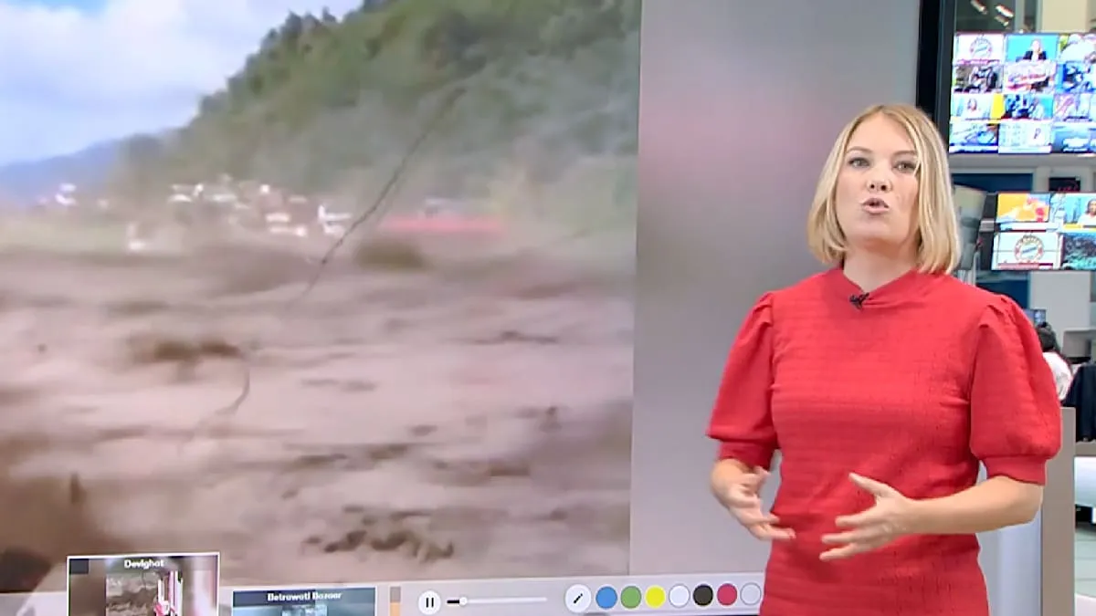
The swift flood, triggered by the bursting of Himalayan glaciers, caused waves of water and mud to surge through mountain valleys, sweeping away settlements, bridges, and communication lines. Data from Copernicus has become a crucial tool for disaster response teams to map the most severely affected areas, an essential step in coordinating rescue efforts and humanitarian aid.
Satellite image analysis shows a drastic expansion of river flows and glacial lakes, confirming experts' concerns about the impact of climate change in high mountain regions. Areas previously green are now covered by thick layers of mud, and many key roads and bridges connecting villages and small towns appear severed, isolating thousands of residents.
Local authorities in both countries face immense challenges in accessing remote areas. Ongoing rescue efforts are hampered by difficult terrain and extreme weather conditions. Initial reports indicate that the number of casualties and missing persons continues to rise, adding to the long list of humanitarian tragedies in the Himalayan region this 2026.
Several media outlets previously reported that casualties in Nepal surged dramatically, with thousands missing. In Tibet, authorities were even forced to halt emergency evacuations as the number of victims reached hundreds, underscoring the severity of the situation.
The role of earth observation technology, such as that provided by Copernicus, is becoming increasingly vital in mitigating disaster risks. With real-time monitoring capabilities and comparative analysis, scientists can identify patterns of environmental change that could trigger disasters, although early warnings are sometimes not enough to prevent total destruction.
This disaster has also raised global concerns regarding the safety of foreign nationals who might be trapped in the region. One case that has drawn attention is the disappearance of an Italian goldsmith, Marco, adding to the long list of missing victims.
The governments of Nepal and Tibet have activated all available resources for emergency response, including the deployment of military and volunteers. However, with 40 kilometers of main roads destroyed, aid distribution has become extremely difficult, leaving many areas isolated.
The international community has expressed sympathy and offered assistance. Humanitarian organizations are raising funds and sending expert teams to the field. However, the scale of destruction shown by satellite images indicates that recovery will require years and significant investment.
This devastating flood in Nepal-Tibet 2026, believed to be triggered by the bursting of Himalayan glaciers, serves as a stark reminder of the region's vulnerability to the impacts of climate change. Long-term mitigation and adaptation efforts are necessary to protect communities living at the foot of the world's highest mountains.
Editorial Insight: The disaster in Nepal and Tibet underscores the urgency of global collaboration in addressing the climate crisis. Satellite imagery, while revealing massive destruction, also offers hope through accurate data essential for rapid response and effective recovery planning. Governments and international agencies must act swiftly to support the region, not only during the emergency phase but also in rebuilding more resilient infrastructure and implementing long-term climate adaptation strategies.